
Shotcrete Intelligence
Automated analysis for underground shotcrete applications.
Shotcrete analysis.
Powered by industry-leading algorithms.
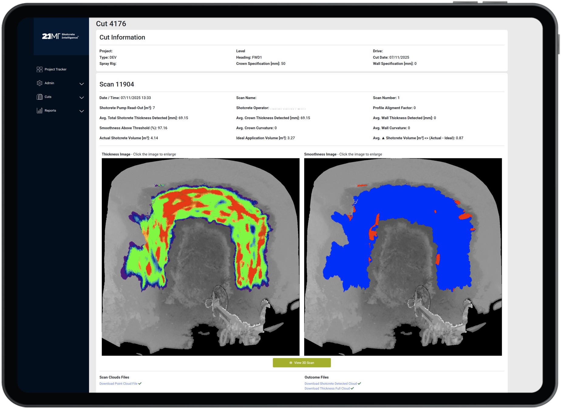
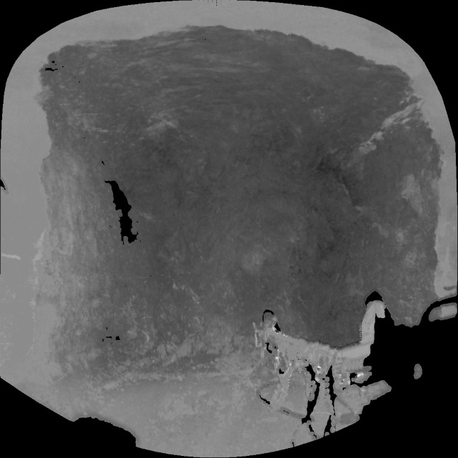
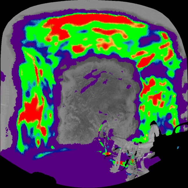
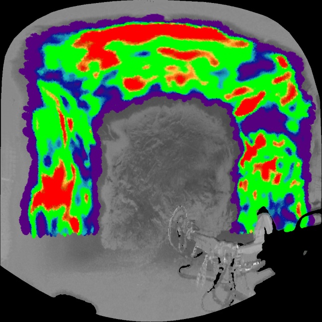
Shotcrete Intelligence automates the detection and analysis of shotcrete in LiDAR scans. The system identifies shotcrete surfaces, measures layer thickness, and characterises surface condition — work that would otherwise demand many hours of manual point cloud processing, assuming it occurs at all.
Enable systematic analysis of shotcrete applications through 21MT Shotcrete Intelligence, our industry-first automated shotcrete detection.

Automated detection in LiDAR scans.
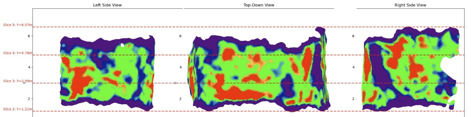
Our shotcrete detection technology automatically analyses thickness distribution, surface condition, and applied volumes across your scanned areas. You can identify where application meets specification, where coverage falls short, and where material is being applied beyond design requirements.
Systematic shotcrete analysis.
This systematic approach reveals patterns that spot-checking misses. Variations between crews, shifts, or equipment become visible in the data, enabling you to address issues before they compound across multiple rounds. The same data supports rehabilitation planning by assessing existing ground support based on measured condition rather than assumptions, and prioritising remediation efforts accordingly
All shotcrete data in one place.
The 21MT Shotcrete Hub serves as a central repository for scan data, analysis results, QA/QC documents and shift reports. Rather than tracking down information across multiple systems or folders, you have a single reference point for what was sprayed, when, and how it measured.
The platform tracks application metrics over time, making it straightforward to identify trends in thickness conformance, material usage, and crew performance. You can compare results across crews, equipment, or sites to establish what's working effectively and where gaps persist.
Export-ready data.
When data needs to be moved elsewhere, e.g. 3D visualisations for client reporting, thickness maps for engineering review, or raw spatial data for integration with other systems, clean shotcrete point clouds are available and ready for export in standard format.

Built for operational scale.
Shotcrete Intelligence is designed to handle the data volumes that underground operations generate. The system works with most LiDAR hardware and file formats, integrating with your established scan workflow without requiring equipment changes.
For engineers, by engineers.
Shotcrete Intelligence removes the bottleneck from scan processing and turns LiDAR into actionable data. Analyse application quality systematically, document ground support condition with precision, and maintain audit-ready records.
Different projects present different requirements. We collaborate with customers to configure reporting formats, analysis parameters, and system integrations that align with your specific workflow and documentation standards.
Shotcrete Analysis. Automated.
Manual assessment of shotcrete thickness and application quality from LiDAR scans is time-intensive and typically limited to spot checks. Shotcrete Intelligence automates the detection and measurement process, providing systematic coverage of every sprayed surface - not merely the areas you have capacity to review manually.
Companies we have provided solutions to
Shotcrete Detection.
Automated Analysis.
Find out how 21MT Shotcrete Intelligence can assist your operation.